My Genealogy and History Page of
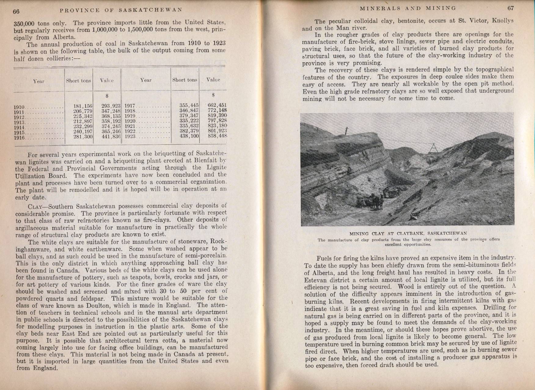
Estevan
Saskatchewan
Canada
 Souris River Valley
 Archive Pictures


Location of Items of Interest below
can be seen in the map above ca 1927
or use the modern Key map below


Modern map above with key below:
A= Old Highway 47 Bridge
B= Old Highway 18 Bridge
C= New Highway 18, west to Torquay
D= Old Highway 18
E= appears I missed this letter?
F= New Highway 47, South to Noonan ND, USA
G= Old Highway 47
H= River Park Pavilion and Hotel, B&B Drive-in
I  = River Bend Nursery (note 3)
J= Original McLeod cabin/ Charlie Vaughn / Jim Lamb farm 
K= Prairie Nursery Farm, managed by Gus Gesell
L= George / Jack Pawson Market Gardens (note 1)
M= Riverdene, Torgeson Summer Home
N= Bastian / Hinzman farm (note 2)
O= Old City Swimming Pool / CPR Dam behind it
P= Woodlawn Regional Park and Golf course
Q= Location of the Estevan Brick Plant
R= Location of the old Estevan Greenhouses

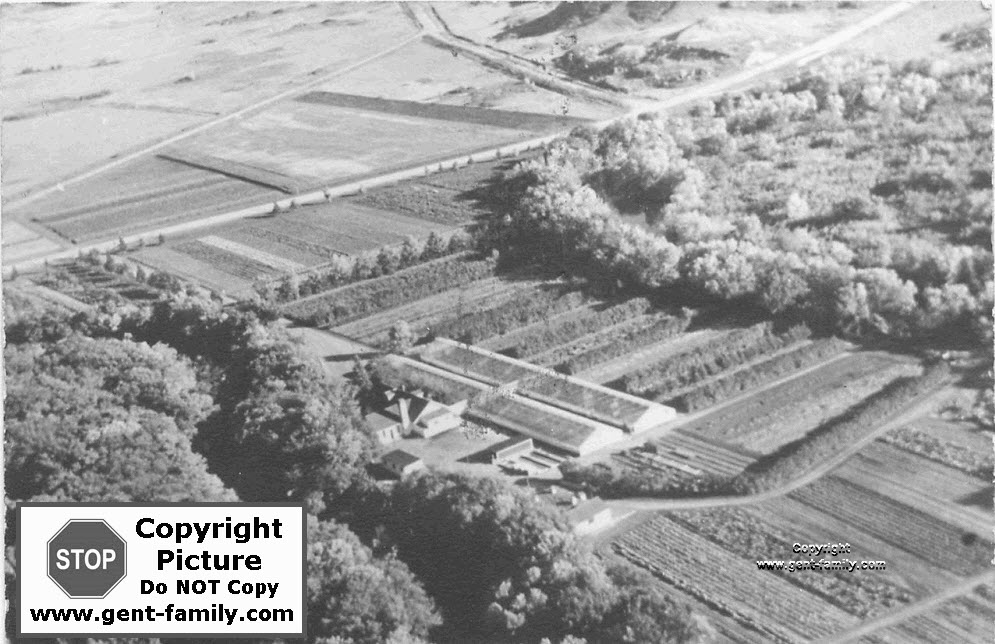
note 1- above the letter L, and east of the road adjacent to the river, was land owned by the Prairie Nurseries, which was bought from George Pawson.  The B&B house will sit on a portion of this land.

note 2- Bastian farm (N), on Sec 10, Tp 2, Rge. 8,  was owned by the Bastian family before Bill and Dorothy Hinzman bought it probably from Wilfrid Bastian in early 1960's.  
 Probably owned in 1911 at least, by a Josiah Bastian.  See my
Bastian Family page for their history
 Note 3- (I) Owned and operated by Gerry Fichtemann and Glenn Coles, River Bend Nursery operated for many years until partially closing in 2008.  Gerry is one of the sons of Walter Fichtemann, owner of the Estevan Greenhouses for many years, which was located south across the river from River Bend.  The Fichtemann family has lived in the Souris Valley, near Highway 47 for years.  I have some fantastic lilies in my garden in Terrace BC from this nursery.  The Fichtemann name is synonymous with plants in the Terrace area for decades.  If you want to know about ANY plant, ask Gerry!  Forget the other garden centres in the city, talk to him.  Now he is semi retired, you might even be able to track him down.  Estevan can be proud this family settled in the area for sure.  Like the commercial says on TV, "the Germans make good stuff!" 
 

  Click on Thumbnail photos below to enlarge in a new window


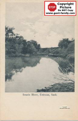
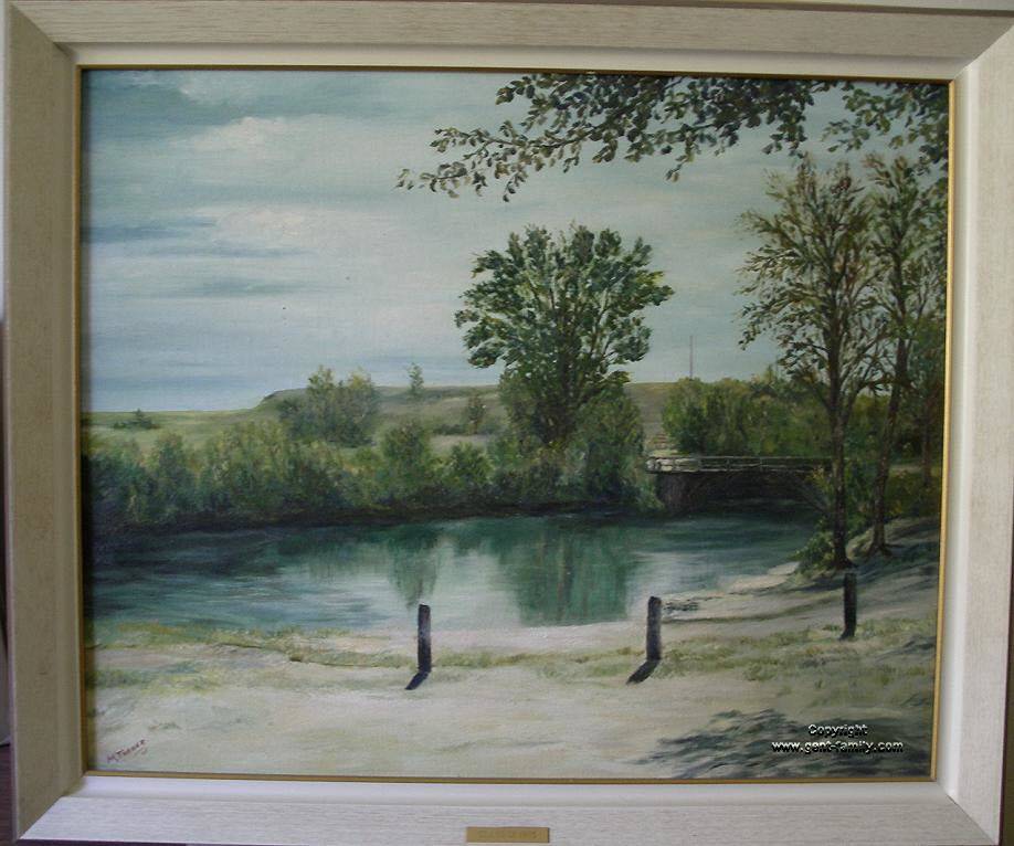
Souris Valley Near Estevan


Vaughan Crossing Bridge
 Souris River Flood
Mar 27, 1928
(see top 1927 map)


Gus and Mae Gesell
at Vaughan's crossing

old B/W photos taken by
my Aunt Rose Gesell


Scenes of the Souris River,
near Vaughan's crossing


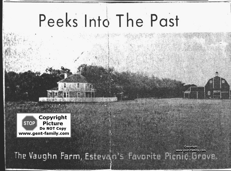
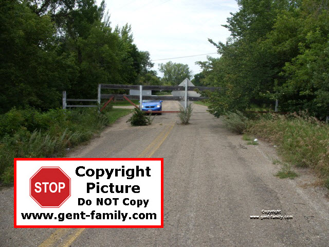
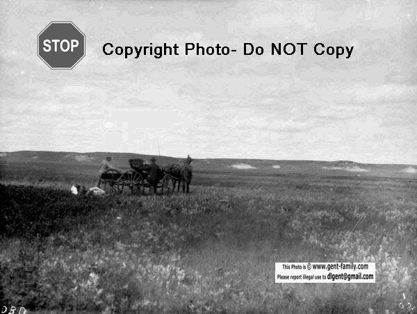
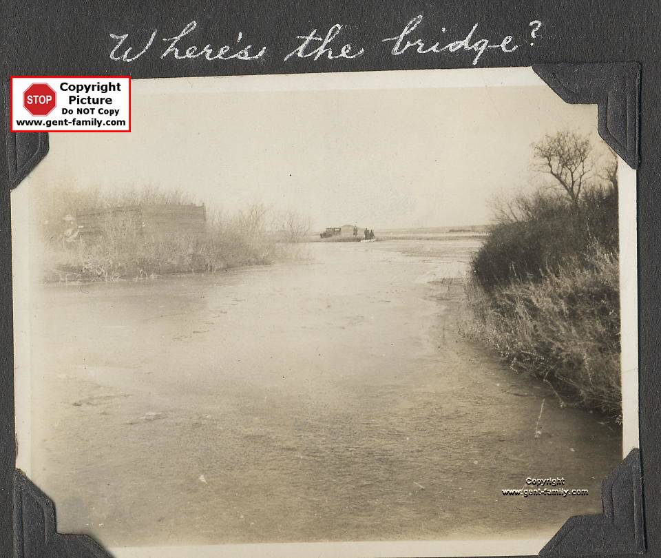
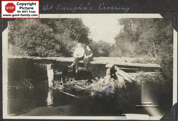
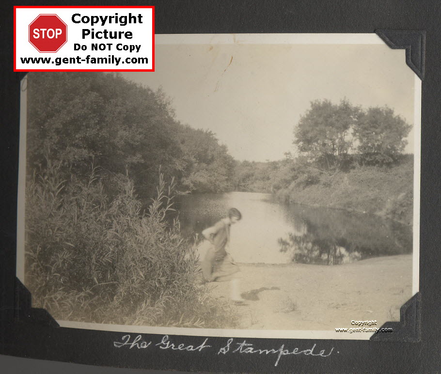
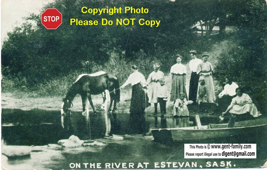
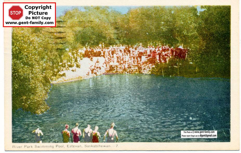
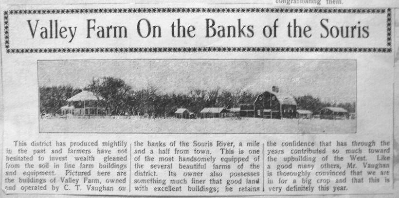
Charles (Charlie) Thomas Vaughan Farm (J)
 South of the Souris River.
Charles Thomas Vaughan
b- July 1878, in Ontario,
d- May 8, 1946
buried in Estevan City Cemetery.
His wife was Ethel Bruce? Van Styck.
she is buried in
Souris Valley Memorial Gardens.
They had a daughter,
 Hazel Girtus Nash (nee Vaughan),
 born Nov 16, 1906, d- Nov 10, 1994
The Vaughn's moved from Stoughton
to Estevan in 1909.
This farm passed from the Vaughn family,
to James (Jim) Lamb.
Today his son, Nathan Lamb and his family
Live here, and farm this area.

This was the location of the log house (J)
built by the Co-founder of Estevan,
Mr John McLeod, for his family.

The Little wooden bridge
 that crosses the Souris
to get to this area,
and the Mets ball diamond there,
is called Vaughan's Crossing
Continue on past the old pool,
the New Souris Valley Theatre,
Cossette Ball Park, and soccer fields.
 
This is the area
where most of my Mom's family,
the Gesell's, learned to swim
They lived on the Prairie Nursery farm
1 mile south of the bridge, on the left.
My grandfather Gus Gesell
was the manager of the farm.

Charlie T. Vaughan, and a Mr. Nesbitt.
opened the first Garage in Estevan,
The Estevan Garage,
A Mr. Robinson took over from Mr. Nesbitt.
It then was known as
Vaughan and Robinson Garage,
NE corner 5th st and 13th ave.
Became Grundeen Motors, Dyer ford,
and many more. 
Now the location of the Post Office.

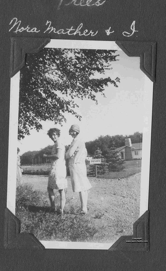
Norah Mather and Rose Gesell
At the Torgeson summer residence,
called Riverdene, (M in map above)
Aug 4, 1929

Norah became a WWII veteran.
Rank of Sergeant
 in the Canadian Women's Army Corps,
and she served overseas.
She was Estevan's Town Clerk,
from 1928 to 1970,
and now has a Park Bench,
placed in her honour,
in front of the Estevan City Hall.
The Mather family were involved
with the operation of Prairie Nurseries.
Her brother Frank was Sales Manager,
and eventually Secretary of the Company.

Rose Gesell, was the daughter
of Gus Gesell,
manager of the Prairie Nursery farm
 south of Vaughn's Crossing.

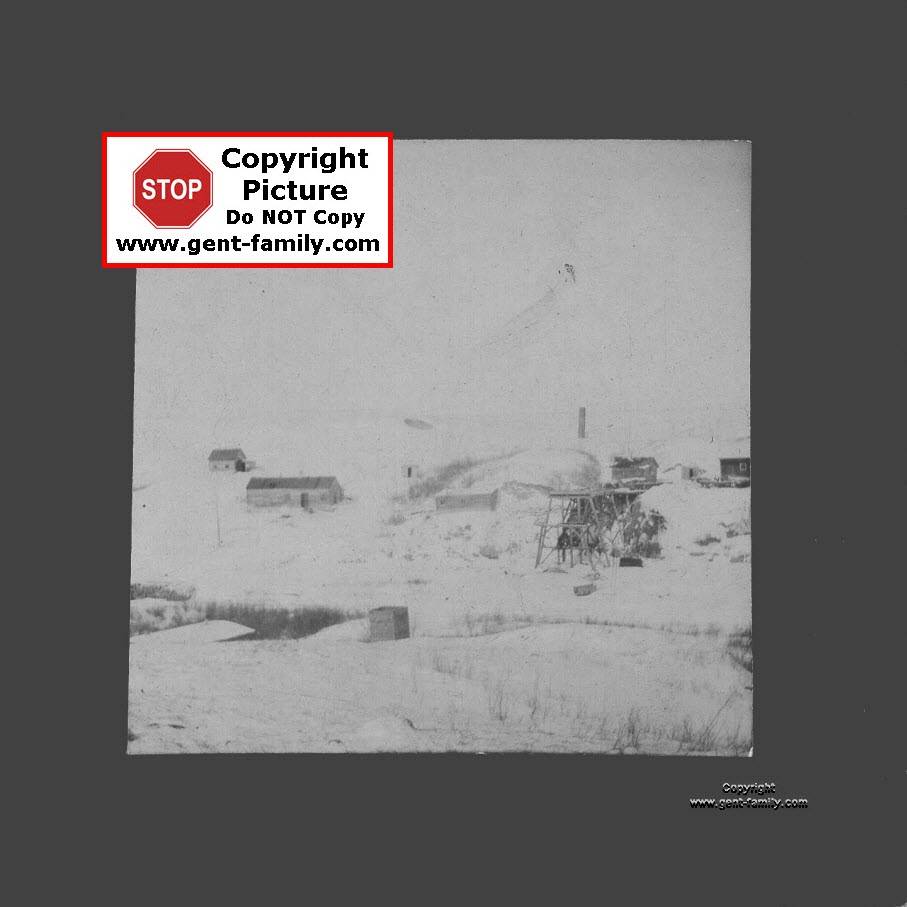
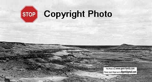
Souris River looking east
from Yardley's Coal Mine

Mr. Henry Yardley
was Estevan's first Mayor.


Souris River Valley Postcard
courtesy Grant Walker in CA


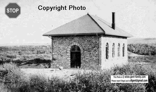
I thought this was an Old Estevan Pump House,
but turns out it is the back side of the
Watrous Pump House,
on East End Little Manitou Lake.
Now I know the rest of the story,
thanks to Mr. Frank Korvemaker.
for more info see this book:
Legacy of Stone: Saskatchewan’s Stone Buildings,
 
by Margaret Hryniuk, Frank Korvemaker & Larry Easton,
p. 214-217.
The picture above doesn't show how big
the building was, or how beautiful it is.
The old stone Masons did wonderful work.
 

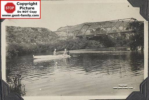
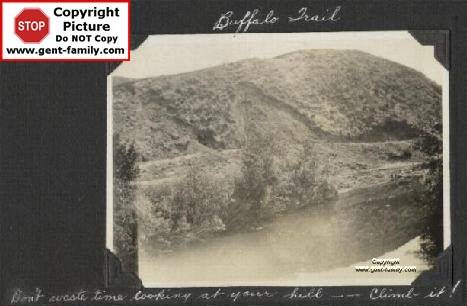
Buffalo trail just north of a bridge
taken by my Aunt Rose Gesell
This could have been around the area,
of the old Power station south of Estevan.

Walter and Emilie Fichtemann, taken at their son ron's wedding
Estevan Greenhouses from the air (R)
Owned by Gesell family friends,
 the Walter Fichtemann family
Located just south
of the old Highway 47 bridge,
straight south of Estevan.


Estevan Brick Ad 1922 (Q)


1923 article on the Clay in Saskatchewan
submitted to me by Mr. Grant Walker, CA. US


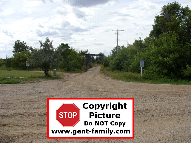
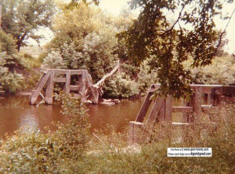
Gesell family on the CPR Dam (O)
with the Billy Bevan farm
 in the distance
photo by Rose Gesell
Billy Bevan was the First
CPR Pumpman
This was located
south of
the old swimming pool,
or south of Souris Valley Theatre today.
and Larry Preddy tells me
it still stands today 2009.
Look in Google Earth
and it is visible from space.


Unknown Coal Mine
If you know the name of this mine
 please let me know.
Picture sent to me by
 Ron Carpenter, with thanks.


1971 cover, Geological Survey of Canada
on the Estevan Lignite Coal Seams
Report from a Salt Lake City source?
why there?
submitted to me by Mr. Grant Walker, CA, USA

 
CPR Dam on the Souris River
(O)

Mr. William (Billy) Bevan
b- June 30, 1870 near Chatham ON
d-  Mar 15, 1935 in Tyvan SK
He was the first CPR pump man in Estevan.
wife- Anne Hobson
b- Feb 15, 1873 in ON
d- Nov 29, 1947 in Wisconsin Rapids, Wisconsin, USA
married in Killarney MB, Dec 1892
both buried in Regina SK.

daughter Lillie (Lily) D. Bevan
b- Aug 8, 1895 in MB, d- ?
married a Mr. Laughlan, Wisconsin
worked for
Moore & Garner Law Firm.

daughter- Irene Bevan
b- May 1902, in MB, married in 1933 to Frank H. Rust, Toronto
Irene taught school in 1925 at Valleyview School,
prior to her marriage

1901 census in Turtle Mountain MB area.
William shown as Irish, Methodist, Farmer
Anne shown as English nationality.
Moved to Estevan in Sept 1903
This was located
south of
the old swimming pool,
or south of Souris Valley Theatre today.

1911 census shows the family
living at the Estevan Brickyard
and William shown as an Engineer.


Postcard of the CPR dam (O)
from Victor Tobias
Unknown lady in the picture.
This was located
south of
the old swimming pool,
or south of Souris Valley Theatre today.
Photos taken from
Vaughan Crossing bridge.


On the river at Estevan,
Postcard ca 1918


River Park swimming hole
Postcards courtesy Grant Walker

River Park, Rotary Park,
Woodlawn Regional Park (P)

Larry Preddy reminded me
 of the "ole swimmin' hole"
Woodlawn Park, and the Souris River,
where myself and
thousands others learned to swim.
Diving off the old bridge, for those that dared!


Wood-ticks, ah now everyone
 is itchy and scratching, right?
It is a shame today,
as thanks to foolish campers,
carrying firewood with them,
all the old Elm trees
have had to be removed from this area,
due to Dutch Elm disease.
My mom and her family learned to swim
at Vaughan's crossing,
just past the "old swimming pool". 
This pool was the
replacement for the river site,
and what a "clean" treat it was.
I remember riding my bike from hillside
just to go for a swim.
Now it is the location of a great
outdoor theatre every summer.
Today the City has a great
water and entertainment centre
with a water slide and everything, all indoors.
Have been there a few times to check it out
and enjoyed every minute of it!


This is a photo of a painting
by artist Marie Turner, ca 1965
It was donated to ECI
by the class of 1965.
The bridge can be seen clearly
in the background.
This photo brought back lots of memories.

The bridge in the park,
near the swimming hole,
was a narrower wooden bridge,
if I remember right.
Pretty well in the center of the park.
Per an article on the history of the park
it says it was constructed by the rotary club
as an access to the Park,
from the south side of the river.

I know it had railings or supports,
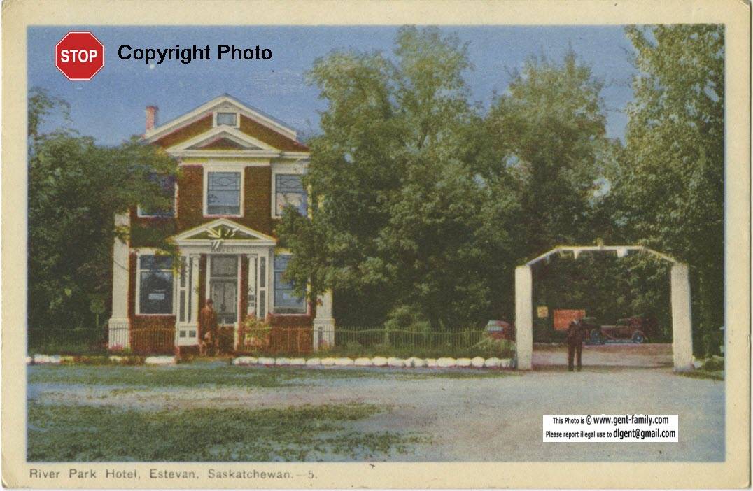
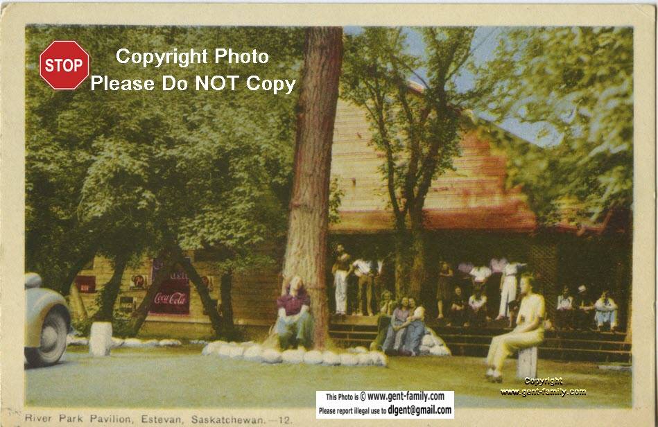
Some of the braver kids used to dive from it.
I could barely swim, so it was not me!


Picture of the Old Swimming Hole
Woodlawn Park, ca 2005-6
Taken from the New Highway 47 bridge.
Looking East.
The swimming hole was located
 where the grassy area appears
 on the north side of the river
Photo by Larry Preddy


Estevan Water Treatment Plant
Aug 2009

River Park Pavilion
aka "The Ponderosa" (H)


River Park Resort Ad

River Park Pavilion was built in 1918,
and owned by 2 brothers
Thomas and James Green.
Located  straight south of Estevan
on the old Highway 47, to the right
just before the turn to the old bridge.
River Bend Nursery
 is just beyond this location.


River Park Hotel
Postcard from Jean Dornian
 Oct 2009

In 1935, the Northern Crown Bank building
in Macoun was bought and moved to
the River Park pavilion site.
This is the building in the picture above.
It was operated by
 the widow of Thomas Green, Wanda,
and Joe Kraft her brother, also
George and William Green, her sons.
They added a tourist park, and cabins.
The property was sold in 1957 to
William O'Laney, and Bert Shipman.


River Park Pavilion ca 1947
Postcard from Jean Dornian
 Oct 2009

From a researcher of the BCMT&T Co, Mr. Craig Williams,
 "Between 1904 and 1910 the Vancouver based British Columbia Mills, Timber and Trading Company marketed a patented system of prefabricated sectional buildings in western Canada.  Once their system was well known they were contracted by the Canadian Bank of Commerce and the Northern Bank to prefabricate branch buildings."


Other memories from the early 60's,
B&B Drive-In,
owned by the O'Laneys.
Located just before the Pavilion.

The corner on the highway,
 where you turned into these places
is not even the highway anymore!
My Dad loved the B&B's Fish and Chips,
and the trees to park under
to have our take-out supper.
In those days it was a real treat to eat-out,
now it is done almost every day, by all of us.
I am sure many dances, weddings etc.
can be remembered at the River Park Pavilion. 
 Nathan and Brenda Lamb
had their reception there for one. 

views from the old hwy 47
looking west.

In the 1930 and 40's many big name bands,
such as Tommy Dorsey, Don Messer,
and Frankie Yankovic performed here.
From the 2000 ECI reunion we found
Bobby Curtola performed here in 1965.

My Aunt Dolly tells me,
on the left, from the old Highway 18,
just before the Water treatment Plant,
was the road into the this dance hall.
Looking at Google Earth, I can see
they would have had to have
a bridge there, to cross the river.
Can't say I have seen any pictures
of this bridge until Oct 2009.
see below

If you look at my Prairie Nursery page,
It has a picture of the
Torgeson's summer home,
called Riverdene. (M)

This is a beautiful spot, just behind the
present day Water Treatment Plant.


Woodlawn Bridge  

The old Highway 47 bridge
south of the City
(see top 1927 map)

view looking south
location of old bridge
 aug 2009

looking N from old bridge

Just after the bridge,
about a 1/4 mile
around a bit of a S turn,
heading south,
on the right side,
was the turn off to the
Estevan Greenhouses.


Rose and Emilie Gesell
Boating on the Souris River,
at the old Highway 47 Bridge

Of course now the new highway
is further east of this spot
and cuts through the old
Woodlawn Park area.


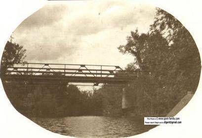
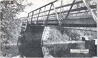
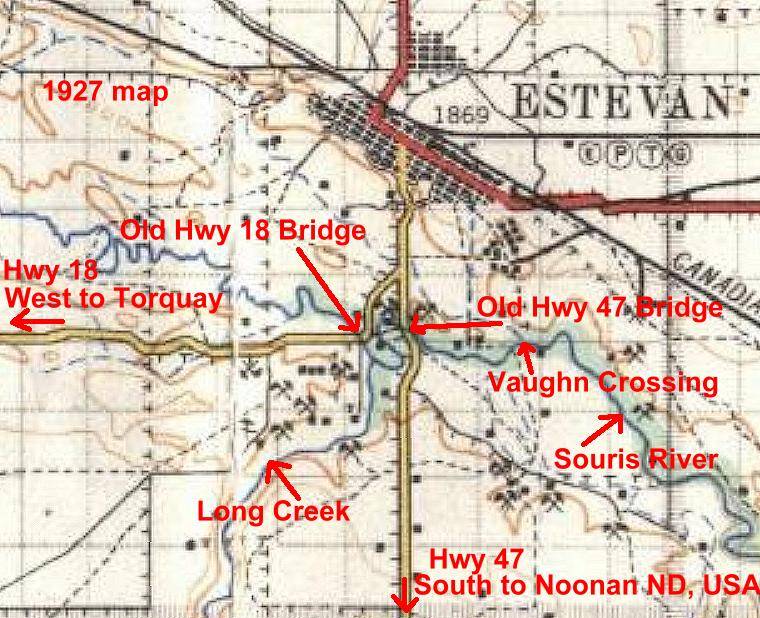
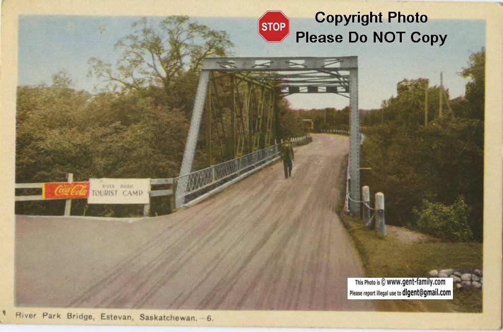
Bridge to River Park Tourist Camp
 ca1946,
left off of Old Highway 18,
south of Estevan
looking East
(see 1927 map above)
The old highway 18,
used to wander along the river
not where it is located today.

From Mrs Jean Dornian,
this explanation below, which clears up
this confusing 2 bridge situation
in this area.

When we went to visit John's parents
 on the farm near Outram, we took highway 18,
turned right at the end of that road
(at the water treatment plant)
and crossed the bridge
(Hwy 18 bridge, on the right) going west,
when we went to Pawson's market garden
we crossed the same bridge then turned left. 
To cross  the other bridge, (picture above),
where the accident happened (see below)
we would have had to turn left,
and it would have taken us into the park
 where the hotel and dance pavilion were,
where the B & B trailer park was situated.

On the reverse of this bridge postcard above
it tells the story that ca1946, a car
hit the boards and went into the river.
One girl and her fiancé drowned,
and the driver managed to escape.
In 1947 they were building
a new bridge to the left of this one
for 2 way traffic.

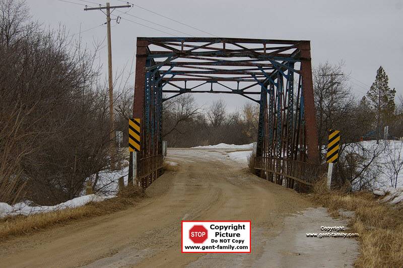
Old Highway 18 Bridge, looking East
taken Mar 24, 2009
Photo by Larry Preddy.

(see 1927 map above)
Just back where the photographer is standing,
is the turnoff to
 Bill and Dorothy Hinzman's Farm,
(Originally the Bastian Farm)
as well as a new B&B down that road.
George Pawson's,
 (later son Jack Pawson's) Market Garden
was down there as well.

On the right, at the bend, is where
the Estevan Water Treatment Plant is today,
and the entrance to Riverdene.
It was the summer home of the
Torge Torgeson family.
George Pawson actually sold part of his land
around 1912 to Mr Torgeson


photo looking west, Aug 2009


Return to Main Estevan Index Page Return To Top Of  Page


No Reproduction in Whole or in Part may be made
without the express Written Permission
 of Doug Gent

Page created by Doug Gent © 2016
Created
June 11, 2011

Quick Links
Personal Family Pages
SE Sask. Web Pages / Dad's 1927 Map of SE Sask. / Hillside Public School
Estevan Collegiate Institute / Nor-West 1904 Newspaper / Terrace BC
BC Tel Terrace District History / Contact page